⚠️ Big Island Safety Notice
The Big Island’s environment can change rapidly — ocean conditions, lava flows, weather, and trails may become dangerous without warning. This guide is for educational purposes only and does not replace real-time assessments, posted warnings, or professional guidance. Always check current conditions before entering the water, hiking, or exploring, and do not proceed if conditions appear unsafe — even if a location is described as “safer.”
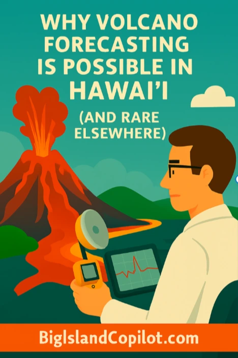
Around the world, volcanic eruptions are often sudden, chaotic, and devastating. Entire communities may receive little warning before explosions, ash clouds, or pyroclastic flows force mass evacuations.
Hawaiʻi is different.
On the Big Island, scientists can often anticipate eruptions days to weeks in advance, estimate where magma is moving, and issue alerts long before lava reaches the surface. This level of volcanic forecasting is rare globally — and it exists in Hawaiʻi for very specific geological reasons.
This guide explains why volcano forecasting works so well in Hawaiʻi, why it’s uncommon elsewhere, and how scientists translate subtle underground signals into real-world warnings.
What Volcano Forecasting Actually Means (and What It Doesn’t)
Volcano forecasting is not About predicting an exact date, time, or eruption size.
Instead, it focuses on:
- Detecting magma movement underground
- Identifying increasing eruption probability
- Estimating likely eruption locations
- Providing early warning windows
In Hawaiʻi, scientists can often say:
“An eruption is increasingly likely within this rift zone in the coming days or weeks.”
That level of confidence is extremely rare worldwide.
The Hawaiian Hotspot Advantage
A Stable, Long-Lived Magma Source
Hawaiʻi sits above a stationary mantle hotspot, unlike volcanoes formed at plate boundaries.
This creates:
- A steady magma supply
- Repeated eruptions from the same systems
- Long-term behavioral consistency
In subduction-zone volcanoes (Japan, Indonesia, the Andes), magma systems are complex, layered, and volatile — making forecasting far more difficult.
Basaltic Lava Makes Prediction Easier
Hawaiʻi’s volcanoes erupt basaltic magma, which:
- Has low silica content
- Flows easily
- Allows gas to escape gradually
This produces effusive eruptions, not sudden explosions.
Because gases escape early:
- Pressure builds slowly
- Ground deformation is measurable
- Earthquake patterns are clearer
Explosive volcanoes trap gas until it releases violently — often with little warning.
Centralized Plumbing Systems Scientists Understand Well
Volcanoes like Kīlauea and Mauna Loa have:
- Central magma reservoirs
- Persistent rift zones
- Repeated eruption pathways
Decades of study have mapped these underground systems with remarkable accuracy. When magma moves, scientists already know where it is most likely headed.
Earthquakes as an Early Warning System
As magma forces its way upward, it fractures surrounding rock — producing earthquake swarms.
In Hawaiʻi:
- Earthquakes often increase gradually
- Depths become shallower over time
- Patterns match known magma routes
Because earthquakes are common on the Big Island, scientists have an excellent baseline for comparison.
👉Big Island Earthquakes: How Common They Are and What to Expect
Ground Deformation: When the Island Swells
Hawaiʻi’s volcanoes physically inflate before many eruptions.
Scientists monitor this using:
- GPS stations
- Tiltmeters
- Satellite radar (InSAR)
Even inches of uplift can signal magma accumulation. Because much of the terrain is open and stable, deformation data in Hawaiʻi is unusually clean and reliable.
Gas Emissions Add Another Layer of Evidence
As magma rises, it releases gases such as sulfur dioxide (SO₂) and carbon dioxide (CO₂).
In Hawaiʻi:
- Gas increases are often gradual
- Trends matter more than spikes
- Gas data confirms seismic and deformation signals
👉Volcanic Gas (VOG): When It’s Dangerous and When It’s Just an Inconvenience
How Scientists Know Where Lava Will Flow
This is one of the most misunderstood aspects of volcano forecasting.
Scientists do not guess.
They rely on:
- Rift zone geometry
- Past eruption pathways
- Topography and slope
- Ground cracking and deformation direction
In Hawaiʻi, lava almost always follows existing structural weaknesses. That’s why eruptions tend to recur along the same rift zones rather than appearing randomly.
This is also why hazard maps on the Big Island are so accurate — they’re built on repeated real-world outcomes.
👉 Recent Big Island Eruptions: What Happened, Where, and Why It Matters
What Happens When a Forecast Is “Wrong”
Sometimes magma intrudes underground and never erupts.
This is not failure.
These events:
- Release pressure safely
- Reduce eruption likelihood elsewhere
- Provide valuable scientific data
In many cases, a non-eruption is actually the best possible outcome. The public often never notices — which is exactly the point.
Forecasting is about risk reduction, not spectacle.
Why Volcano Alerts Often Sound Scarier Than They Are
Visitors are often confused when:
- Parks close during quiet periods
- Alerts increase before visible activity
- Access is restricted without lava in sight
These actions happen early, when intervention still matters.
Waiting until lava is visible would be too late.
👉 Volcano National Park Closures Explained (What’s Open and What’s Not)
Why Forecasting Works in Hawaiʻi but Rarely Elsewhere
Most volcanoes worldwide are:
- High-silica systems
- Explosive stratovolcanoes
- Poorly monitored
- Located in remote or unstable regions
These factors lead to:
- Rapid pressure buildup
- Minimal warning
- Unpredictable vent locations
Hawaiʻi’s calm, data-rich, basaltic systems are the exception — not the rule.
Why This Makes Hawaiʻi One of the Safest Volcanic Regions on Earth
Because of effective forecasting:
- Evacuations are orderly
- Fatalities are extremely rare
- Infrastructure damage is minimized
Hawaiʻi is considered a global model for volcanic hazard management.
This is also why lava viewing is rare and controlled.
👉 Why Lava Viewing Is Rare — and Why That’s Actually a Good Thing
Authoritative Monitoring Behind the Scenes
The USGS Hawaiian Volcano Observatory (HVO) continuously monitors:
- Earthquakes
- Ground deformation
- Gas emissions
- Thermal changes
Their long-term datasets are among the best in the world.
https://www.usgs.gov/volcanoes/hawaiian-volcano-observatory
Key Takeaways
- Volcano forecasting works in Hawaiʻi because of:
- Basaltic lava
- Stable hotspot geology
- Predictable magma pathways
- Exceptional monitoring
- Forecasting reduces risk, not uncertainty
- Early warnings save lives and landscapes
- Quiet periods are often signs of success
⚠️ Quick Safety Reminder
Conditions can change suddenly. Always check local conditions, warnings, and official guidance before entering the ocean, lava areas, or trails. Safety is your responsibility.
Aloha, did you like this page?